Navigating the Catubig River © 2004
MY one day trip along the Catubig River was a journey back in time. A look at the few remaining rustic structures still standing in the area will remind visitors that once in this place a fortuity of great significance took place and etched a page in history. The riverboat trip was an exotic exposure and the thrill that went with it was simply exhilarating.
MY one day trip along the Catubig River was a journey back in time. A look at the few remaining rustic structures still standing in the area will remind visitors that once in this place a fortuity of great significance took place and etched a page in history. The riverboat trip was an exotic exposure and the thrill that went with it was simply exhilarating.
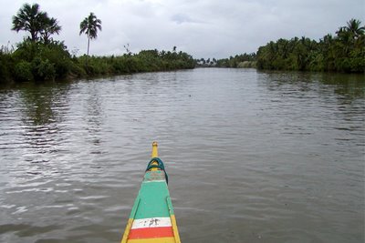
The Catubig River is Northern Samar’s longest river. It is at least 30 kilometers long and passes through two river towns. The river has two mouths - one in Pangpang and one in the Laoang Island inlet. The river ends right after the town of Las Navas, a remote municipality surrounded by low rugged hills and lush forests.
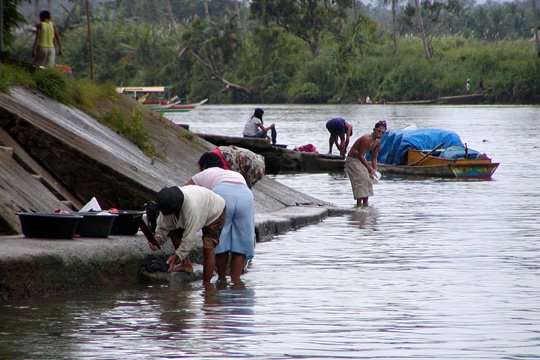
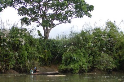
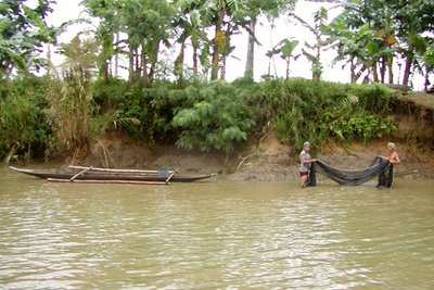
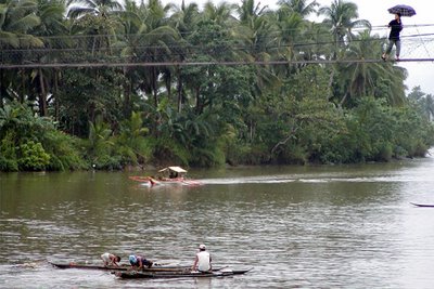
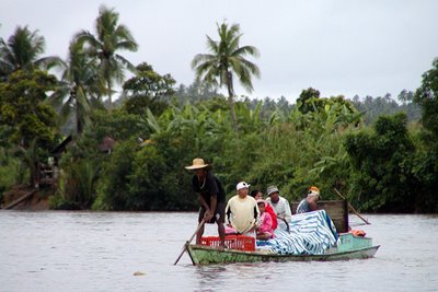
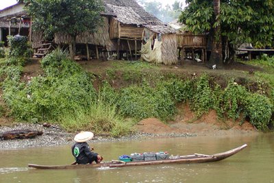
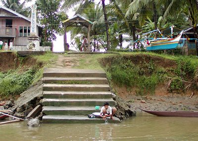
For local residents, the river serves as a cord of life. It is the only access to all their needs – water to catch fish, water to irrigate their farmlands, water for their animals, water to wash their clothes, water to bath in, and water to transport their basic needs.

A local historian whom I met during my three-day stay in the province told me that the river got its name from the town of Catubig, an old Spanish pueblo and cabezeria. Although I was told that the original location of the town was in Palapag which was on the eastern side of the island facing the Pacific Ocean, the town served as the residence of the Cabo de Espiritu Santo during the Spanish times. The region was then called Ibabao which is today Northern Samar.

I was told that the Sumoroy Rebellion (1649-1650) led by the Waray hero Juan Ponce Sumuroy made Palapag a famous byword in Philippine history. One of the trusted co-conspirators of Sumuroy, David Dula y Goiti, sustained the Filipino quest for motherland with greater vigor. He was however wounded in a battle, was captured and later was executed in Palapag by the Spaniards together with his seven key lieutenants. They were accused of masterminding several attacks on Spanish detachments. Up to this day, Samar is noted for being a hotbed for insurgents.
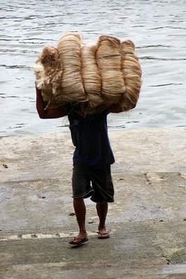

During the 18th Century, Ibabao or Northern Samar became the stopover of the Acapulco galleon trade when its abaca, bees wax and other agricultural produce were in demand in Spain, Mexico and Peru. Palapag was the Pacific port of call while the town of Capul, in the San Bernardino Strait was the provisioning call of the galleons which plied between Manila and Mexico once a year. Capul, formerly known as Abak (after the ancient ruler of Java who brought the first settlers to Ibabao), probably got its name from Acapulco. To this day, abaca is still one of the major products found in the province. Today, abaca growers use the Catubig River to ship their raw products to buyers and distributors.

As I traveled along the river, I could see the rich alluvial soil of the river banks. The constant erosion of the soil contributes to the water’s brown murkiness. The soil in this area is predominantly silt and clay loam with a fine texture and a high water retention capacity. This soil type, I was told, is fertile and suitable for lowland rice farming.

Northern Samar is bounded on the north by the San Bernardino Strait, on the east by the Pacific Ocean, on the west by the Samar Sea, and on the south by Western Samar. I was told that the total land area of Norhtern Samar is 3,498 sq. km.

Northern Samar is composed largely of low and extremely rugged hills and small lowland areas. It also has small and discontinuous areas along the coasts and its rivers are usually accompanied by alluvial plains and valleys. The province is endowed with relatively rich and fertile soil that most crops can grow on it. It is rustic and picturesque.

As we cruised along the river, I could not help but imagined how the Nortehanons of Northern Samar figured prominently during the Spanish and American occupation of the Philippines. It was said that the river was a vital strategic access of the Pulahanes who protractedly fought a guerilla war even after the capture of General Lucban in Catubig in 1902 by the American forces.

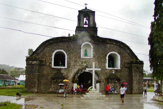
I have read a lot of interesting stories about Northern Samar when I was still a student. During the Philippine-American War (1899-1913), I learned that the town of Catubig was the scene of a battle between the Samarnons and the Americans. It was later known as the Siege of Catubig. The century-old Saint Joseph the Worker church near the bank of the river is a surviving witness to the siege which took place on April 15, 1901. It was said that the battle lasted for four days.

History footnotes cited the Siege of Catubig as a long and bloody engagement fought during this period of the Philippine-American War, in which Filipino guerrillas launched a surprise attack against a detachment of U.S. infantry, and then forced them to abandon the town after a four-day siege. The siege began on April 15, 1900 and lasted on April 19 before the survivors were rescued. The attack was very similar to the infamous Balangiga Massacre farther south of Catubig a year later.


A few days before the battle, the U.S. 43d Infantry Regiment was sent to Catubig to stop guerrillas from getting supplies from suspected sympathizers. This was a time when conventional war in the Philippines had been abandoned and had now entered the new phase of guerilla warfare. The 43rd were relatively raw recruits and had little experience in combat. In fact, they had only been in the islands for four months before they were ordered to Catubig. I could just imagine how life was like back then when this place was untamed. It was probably America’s first Vietnam War.


April 15 seemed like a typical Sunday morning for the regiment, but suddenly rushing down from the surrounding hills and town itself came hundreds of Filipino guerillas armed with bolos (machetes), pistols, spears, and German Mauser rifles. Strange as it seems, the guerillas let loose a tremendous volley of “cannon” and rifle fire that drove the entire regiment into their barracks. For two days, the regiment withstood a withering fire with a loss of only two men, before their barracks were lit ablaze. Unable to extinguish the fire, the Americans were forced to flee the burning building and face the attackers.

When they reached the open, the whole regiment lost all coordination, and broke up into two groups, one running to the boats moored on the river bank, and another to the rear of the barracks. All 15 men running for the boats were killed, either cut down in the streets, or shot in the boats. The others made makeshift trenches, dug with their bayonets, and for another two days kept the guerillas in check until a rescue party in the steamer Lao Aug came to their aid. The relief force managed to save the survivors under a hail of Mauser bullets, making it back to their base before the guerillas could regroup and attack again.

Historical accounts of the siege documented that of the 31 American soldiers of the 43rd, 21 were killed and 8 were wounded. The rebel losses were unknown. American accounts claim as high as 150. The survivors of Company C, who were nearly annihilated during the Balangiga Massacre, also claimed extremely high losses on the Filipino side.


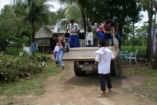
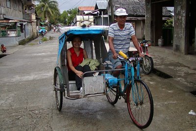
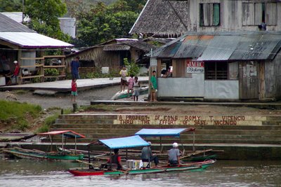
The town of Catubig can also be reached by land but one has to travel a long and arduous journey on paved and un-paved roads. However, some locals say that the best way to reach the river towns is by riverboat ride on the Catubig River. Catubig is a 4th class municipality. According to a 2000 census, it has a population of 26,917 in 5,015 households.

The next town further upriver is Las Navas, a 4th class municipality that has a population of 29,346 in 5,641 households. Legend says that Las Navas got its name from a Spanish officer named Delas Navas who explored the northern part of Samar during the Spanish times. The residents say the officer sailed with his men upstream the Catubig River and reached a place called Binongtu-an. The place was later changed to Las Navas to serve as a reminder to the people that a prominent Spanish officer stayed there. The people accepted the proposed name and changed the name Binongtu – an to Las Navas.
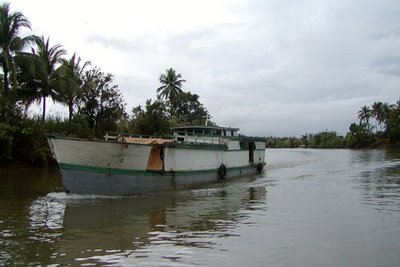

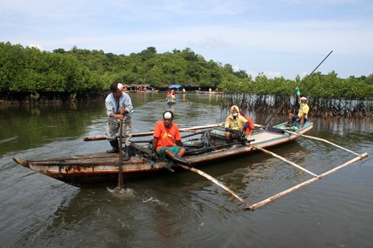
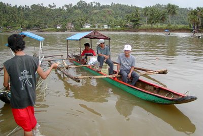
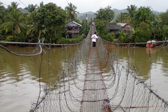
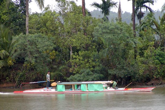
After the name Las Navas was acceted by the natives, a church was constructed near the bank of the Catubig River. Today the wide lowland between the rugged hills and the river is now known as the Catubig Valley. The river is said to be big enough for small tonnage barges or motored vessels to easily sail to the source of the river.
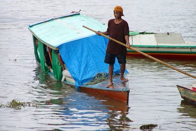

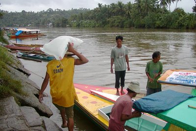
I reached Las Navas before lunch. The pump boat operator told me that they charge riders P20.00 per person to ply from Las Navas to Catubig and vice versa. The boats dock at Lo-ok in Catubig and Lo-ok, too in Las Navas. It leaves Las Navas at 5:00 a.m. and was always expected to arrive 5:30 a.m. in Catubig.


As our riverboat docked on the concreted river bank, the boatman told me that there are more brooks and creeks that can be found further inland if I was to take a hike. The offer was very inviting but I did not take the risk because of my unfamiliarity with the place and its people. I also had limited time to stay in the area. There was a saying that to travel across the Catubig at night would be dangerous. The Catubig is the most famous river in the area. It is commonly called the Main River as compared to the Hinaga and Hagbay rivers in Western and Eastern Samar.

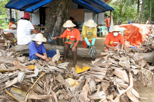
Las Navas is primarily an agricultural municipality with rice production as a major activity. However, of the total land area, 4,733 hectares are planted with rice, and 3,275.2 hectares for coconut. The remaining areas are planted with abaca with a total of 1, 332.5 hectares, root crops has a total of 540 hectares. Livestocks and poultry are considered as major economic activities for small farmers and their families.
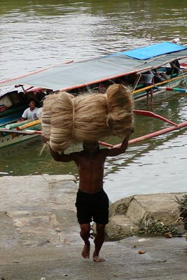

The boatman told me that other major resources such as timber products, tikog and rattan are also abundant in Las Navas, such offering a bright prospect for agricultural development and for subsequent industrialization thru small and medium scale industries.

Several kilometers past Las Navas in the upper most part of the stream, the Pinipisakan falls can be found. I did not have the chance to reach the area as dark rain clouds threatened our journey upstream. Reaching Las Navas town was good enough for me.
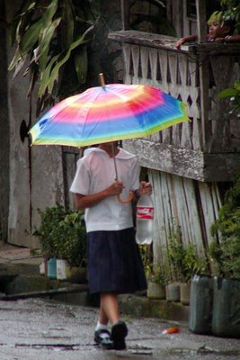

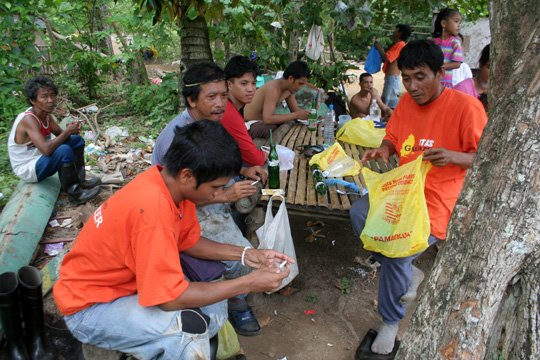
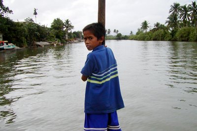
I discovered that the people of the river towns are friendly and accommodating. They welcomed strangers with open arms. The children of Las Navas, though were shy, managed to give away a smile when they saw us. I would say that the famous Samar hospitality is something that must be experienced by those who wish to travel to the island’s hinterlands.

Soon it was time for me to go back to Catubig town to catch the last ride back to Catarman. It was a rewind of the trip. But it also seemed to me like an emersion of life itself.

I was enthralled and fascinated by the trip. I was also glad that I was on my way back from what looked like an untamed frontier. It was like coming back from a journey back in time when Springfield rifles clashed with bolos.
My thoughts hover as I looked at the people doing about their chores by the banks of the river. For me, it seemed that despite the vicissitudes of the last two centuries, the river’s poignant tranquility seemed to have arrested the development of the river towns and the people who depend on it.
My thoughts hover as I looked at the people doing about their chores by the banks of the river. For me, it seemed that despite the vicissitudes of the last two centuries, the river’s poignant tranquility seemed to have arrested the development of the river towns and the people who depend on it.
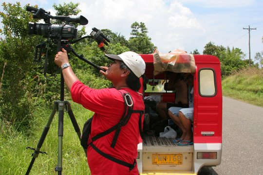
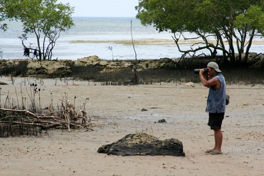
The subjective photographs I have taken during the Catubig River journey will always remind me of this beautiful but mysterious place. I hope that by sharing the images with the readers, it would serve as visual inspiration to those who crave for the surreal outdoor experience.
posted by JOGA at 9:15 PM
1 comments
![]()
![]()